

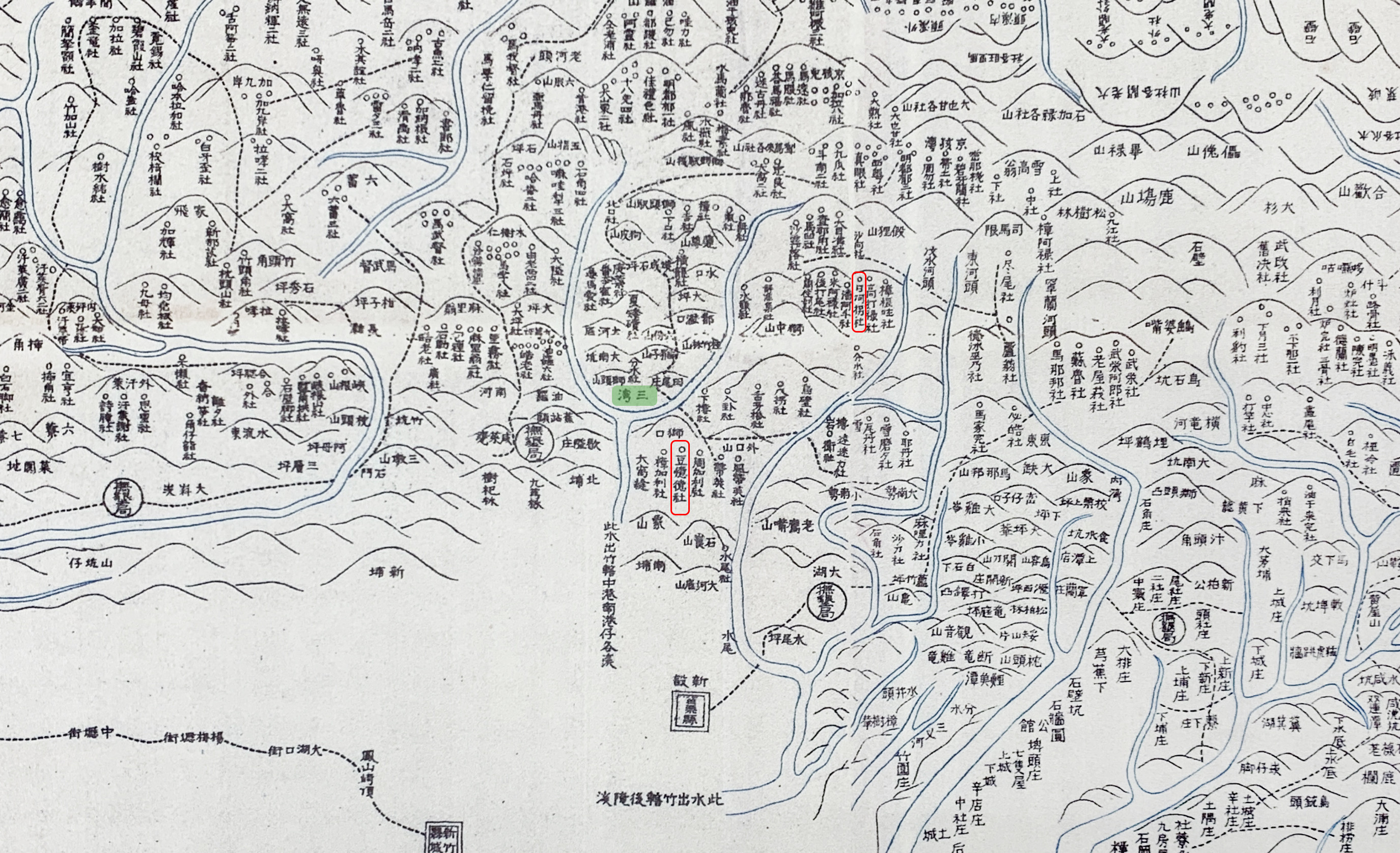
Taiwan Aboriginal Map indicates the name and distribution of the SaySiyat communities during the late Qing dynasty. The clan names were adopted from SaySiyat people's names. For example, Zhangkalihshè(樟加利社) near Shikou(獅口), combines a surname Zhang(樟), or Menrakesi in SaySiyat, and a given name kalih (加利). Similarly, Taw'itihshè(豆憶德社) is a combination of our surname Tawtawazay(豆), and a Han-Chinese phonetic translation of a given name 'itih. The map shows, at that time, the SaySiyat people were distributed throughout the Zhonggang River Basin (中港溪流域) and the Houlong River Basin (後龍溪流域). Zhangkalihshè, Taw'itihshè and others even lived on the western plain of Taiwan other than the "Three Bays" area, proving the elder's statements that the SaySiyat people used to live on the western plains.
.jpg)
.jpg)
-
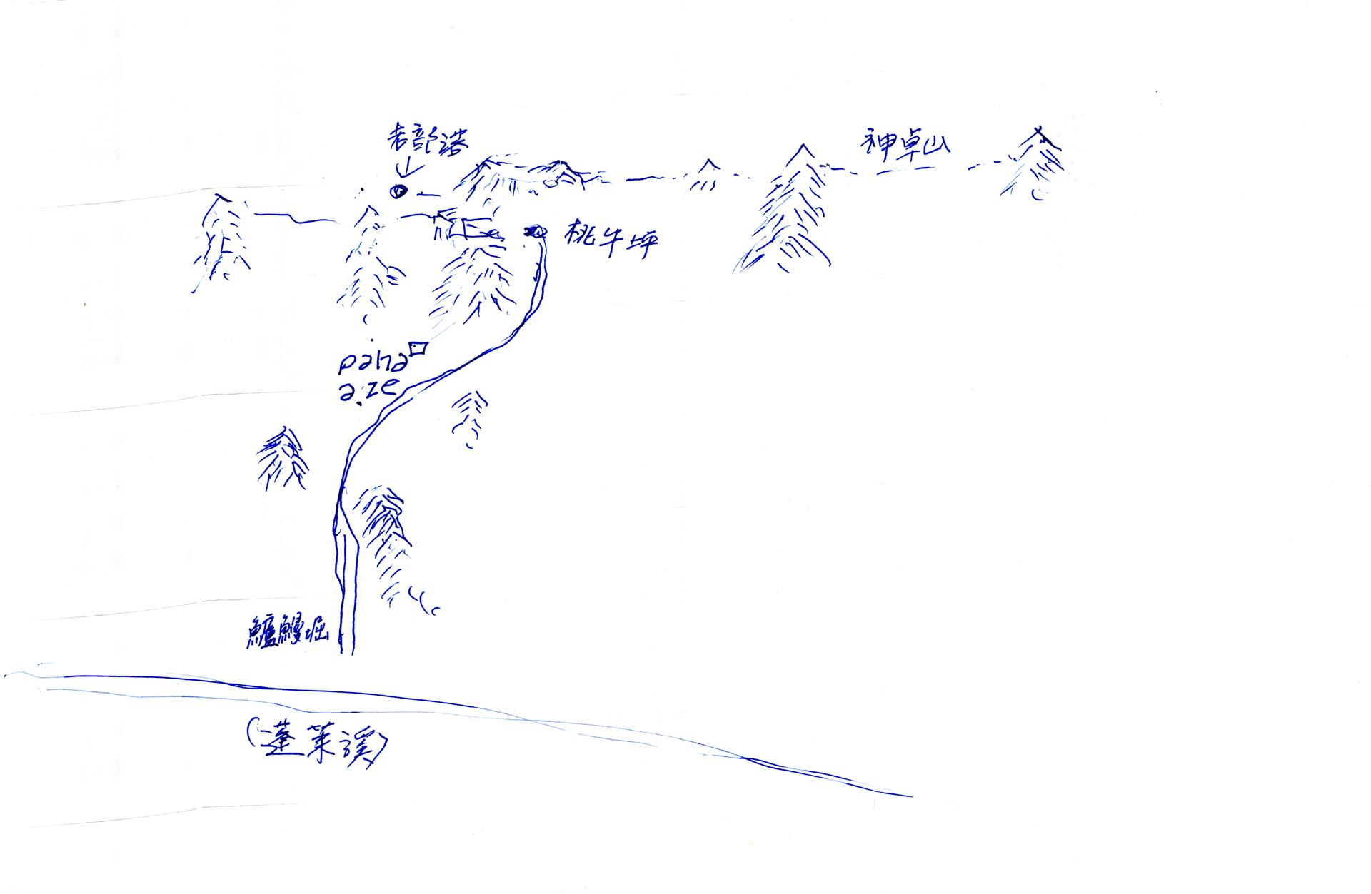
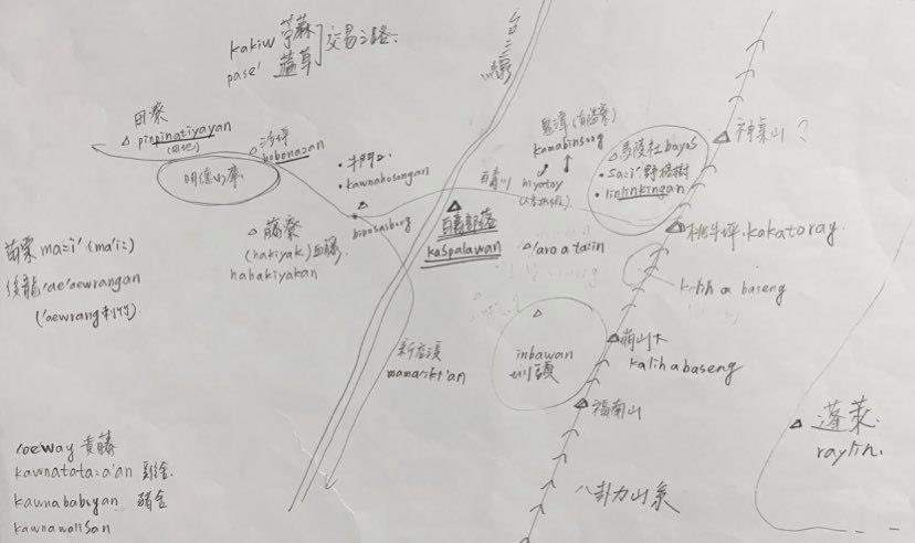
(1180_722px)_%E5%B7%A5%E4%BD%9C%E5%8D%80%E5%9F%9F%201_%E5%B7%A5%E4%BD%9C%E5%8D%80%E5%9F%9F%201_21082617481039316.jpg) Through these ancient SaySiyat location names, the mountain and forest space is represented through different perspectives. These paths of migration involve hundreds of years of history.
Through these ancient SaySiyat location names, the mountain and forest space is represented through different perspectives. These paths of migration involve hundreds of years of history.
.jpg)
.jpg)